We have visited the San Francisco Bay area a few times, visiting with friends. The last couple of times, our kids were very young. This time around, they were eager and excited for the road trip, so we left the planning to them.
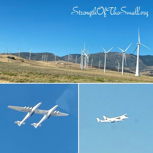
Driving through the Mojave Desert, we were amazed by the number of massive wind turbines. According the website power-technology.com, Alta Wind Energy Center (AWEC), also known as the Mojave Wind Farm, is the second-largest onshore wind energy project in the world and consists of wind farms constructed in the 1970s and 1980s.
We spotted a Twin-Fuselage Stratolaunch Aircraft from the Mojave Air and Space Port in Mojave. This aircraft is said to be the world’s largest airplane—with a wingspan longer than an American football field, measuring 385 feet.
Sequoia National Park
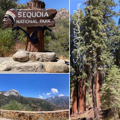
We visited the Sequoia National Park and experience its beauty first hand.
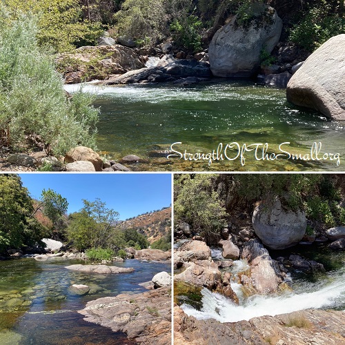
We mostly drove, as parking was scarce. We drove by the Tunnel Rock, Potwisha Campground, Hospital Rock, and stopped by the Middle Fork Kaweah River to stretch our legs. After reaching The Giant Forest Grove famed for its giant sequoia trees, we found a spot to park and admire nature’s beauty.
The waterfalls were breathtaking.
The Japanese Tea Garden
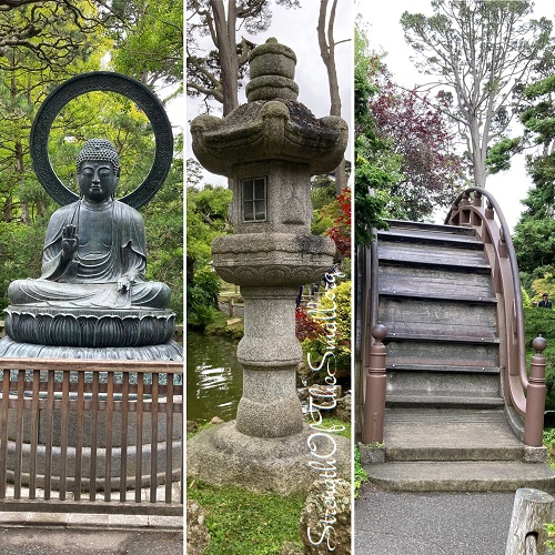
We visited the Japanese Tea Garden of Golden Gate Park.
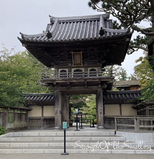
The Temple Gate and Buddhist shrine are fascinating.
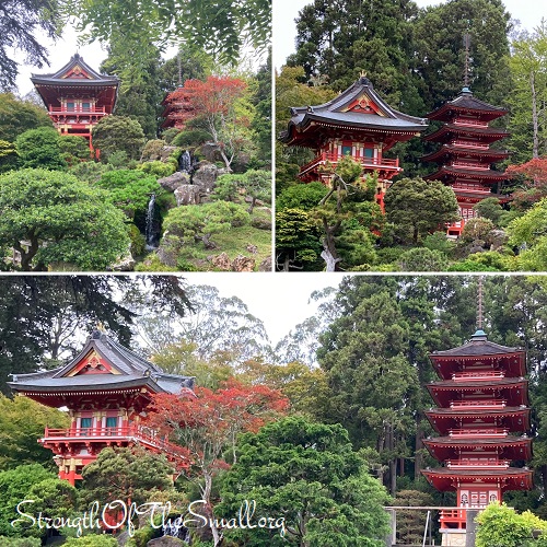
The memorials, statues, pagodas, bridge, as well as other visual arts are captivating.
The first thing that caught my eyes was the stone memorial to Makoto Hagiwara by Ruth Asawa. Makoto Hagiwara was a Japanese-born American landscape designer as well as the caretaker of the Japanese Tea Garden at Golden Gate Park in San Francisco, California, from 1895 until his death in 1925. He is also credited for inventing the fortune cookie in California, which he served at the Tea Garden.
I love the Tsukubai, which is a stone wash basin found in some Japanese tea gardens, temples, and shrines. It is placed near a tearoom and provided for visitors to cleanse themselves by washing their hands and rinsing their mouths.
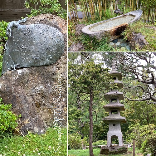
The garden features gorgeous landscapes with lots of native Japanese native plants, stepping stone paths, a zen garden, pagodas, stone lanterns, waterfalls, and a few koi ponds.
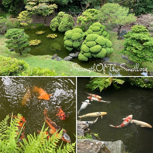
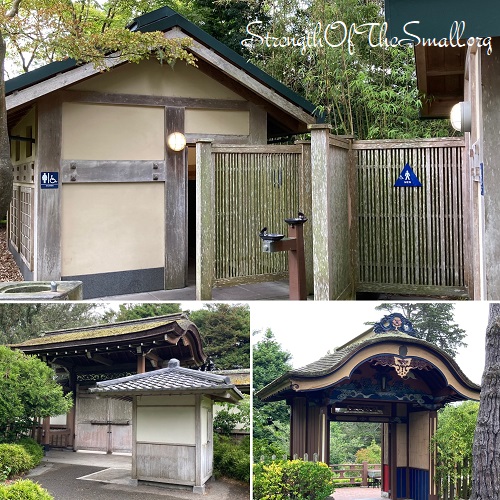
The Japanese architecture, the garden, and the visual arts are so beautiful.
Located in the Music Concourse at Golden Gate Park, the Spreckels Temple of Music, also known as the Bandshell, is a venue for free concerts. The structure, which is about 124 years old, was a gift to the city from sugar magnate Claus Spreckels. It is surrounded by the California Academy of Science, the de Young Museum and the Japanese Tea Garden.
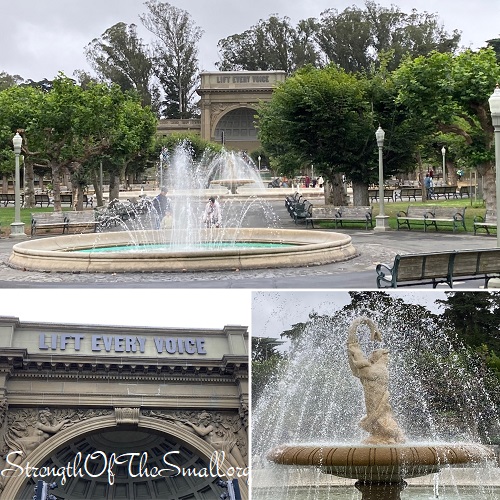
There are several monuments in Golden Gate Park’s Music Concourse with the Francis Scott Key monument being one of the largest. The Apple Cider Press, an 1892 bronze sculpture by Thomas Shields Clark. A bronze bust of Ulysses S. Grant by Rupert Schmid.
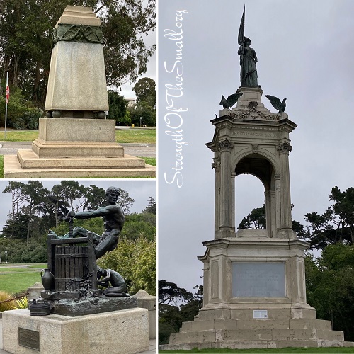
Other monuments, statues, and landmarks in Golden Gate Park:
- The Sphinxes by Arthur Putnam
- A monument of Padre Junípero Serra by Douglas Tilden
- A sculpture of Leonidas, King of Sparta by George Geefs
- The Bronze Lion by R. Hinton Perry
- The Robert Emmet statue by Jerome Connor
- The Sundial by M. Earl Cummings (commemorating Sir Francis Drake, Juan de Cabrillo, and Fortuo Ximines)
- The John J. Pershing Monument by Haig Patigian
- The Giuseppe Verdi Monument by Orazio Grossoni
- The Japanese Tea Garden Structures
- The Goethe and Schiller Monument by Ernst Friedrich August Rietschel
- The Thomas Starr King Monument by Daniel Chester French
- The North Tunnel Under JFK Drive (the tunnel that crosses under John F. Kennedy Drive to the Conservatory)
- The Phoebe Hearst and Rideout Memorial fountains
- The Ludwig Van Beethoven Monument by Henry Baerer. The monument features a female figure standing below the bust and holding a lyre
- The Cervantes Memorial by Jo Mora, consisting of Don Quixote and Sancho Panza kneeling before a bust of Cervantes
- The Doughboy Statue by Melvin Earl Cummings and dedicated to the soldiers who died in the World Wars I and II
- The Pool of Enchantment with a set of bronze sculptures (consisting of an Indian boy playing a musical pipe and two attentive California mountain lions) by M. Earl Cummings
- The Dutch Windmill and the Murphy Windmill
- The Conservatory of Flowers
- The McLaren Lodge
- The Park Emergency Aid Station
- The Sharon Building
Click here to learn about the history of the Music Concourse and here to learn about the history of the Golden Gate Park.
Sand City Beach
According to californiabeaches.com, Sand City is a tiny community including the highest dunes found along the state’s Central Coast. Sand City Beach is known for its strong winds, and it is a popular spot for paragliding.
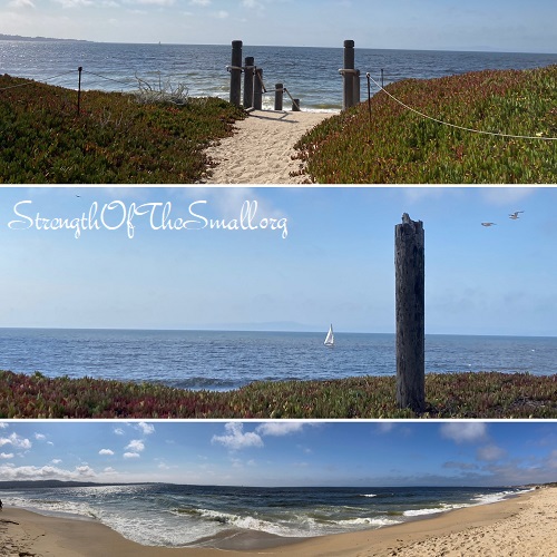
Big Sur
As the website SeeMonterey.com puts it, Big Sur is a majestic stretch of rocky cliffs, lush mountains, panoramic beaches, and coastal redwood forests located off the famous Pacific Coast Highway. Outdoor adventure is abundant with epic hiking trails, picturesque camping, and breathtaking historic & state parks to be explored.
Driving along Highway 1 was wonderful and Bixby Bridge was thrilling.
Always check the weather service, highway condition, and pay attention to posted signs along the way for road closure due to a crash, maintenance, or rocks falling and blocking the road. Once you engage yourself on Highway 1 and can’t continue due to road closure ahead, then you will have to turn around because there are no detours.
We drove along Monterey, California Sea Otter Game Refuge, Carmel, and Big Sur.
We made a quick stop at a restaurant to stretch our legs and for refreshments before turning around due to road closure ahead from falling rocks.
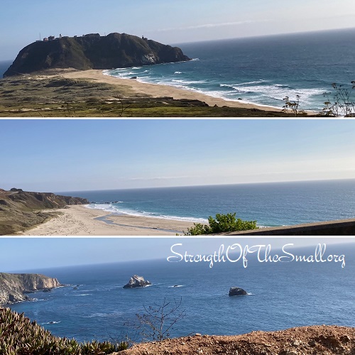
Indeed, California Pacific Coast Highway takes you along some of the most amazing coastal scenery in the US. Always wear a seatbelt, keep your eyes on the road, respect the speed limit as well as other guidelines, respect other drivers and bicyclists, and drive safely. Practice extreme caution when driving at night, as it can be dangerous.
We had a wonderful time in San Francisco, regardless of the cold weather, and the drive back home was entertaining.
